West Valley Town Histories
Avondale History

Avondale's founding father, William "Billy" G. Moore, arrived in Arizona in the late 1860s, settling near the Agua Fria (Spanish for "cold water") River around 1880. Legend has it that Moore was a member of the Quantrill gang of Civil War guerrillas led by Willard Clarke Quantrill. Moore, the gang's blacksmith, was banished by the governor of Missouri to the Arizona Territory in 1867 (he was later pardoned). He first took up residence near Kingman, before becoming the first settler to put roots into the desert land by the Agua Fria River.
Billy Moore called his settlement "Coldwater, Arizona" - apparently both for the river and for the water that flowed from a local spring. He served a brief stint as Justice of the Peace for the Agua Fria area. He bought land, established a stage stop on the Butterfield Stage Run, erected a saloon and a general store, and was even Postmaster of Coldwater from 1901 till 1905.
In the early 1900s, the Coldwater post office moved to a site near the nearby Avondale Ranch. By then, Billy Moore had lost his position as Postmaster, reportedly because he violated postal regulations, which prohibited the dispensing of alcohol from the same building that houses a post office.
The post office soon became known as Avondale, and the name Coldwater was discontinued.
In December 1946 the City of Avondale was incorporated. Each year, Avondale and its neighboring communities celebrate the area's colorful past with a parade down Western Avenue, a fun-filled carnival, burro races, a golf tournament and much more.
For more information about Billy Moore Days, traditionally held during the third week in October, please contact the Southwest Valley Chamber of Commerce at (623) 932-2260.
For more information about Avondale history, visit the Three Rivers Historical Society, or call 623-386-1397.
Buckeye History
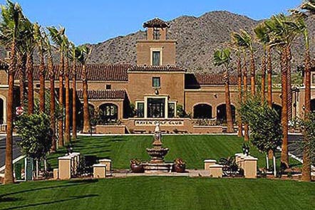
In 1877, the founder of the settlement that was to become the Town of Buckeye led a party of six men, three women and ten children, from Creston Iowa, bound for Arizona. The leader of this party was Thomas Newt Clanton whose purpose for coming west was to foster good health. It was a good move for him – he lived in Arizona for 49 years before his death at the age of 82.
Development in the Buckeye Valley received its first great boost with the construction of the Buckeye Canal. In 1884, Malin M. Jackson named the canal in honor of his native state of Ohio, the Buckeye State. Clanton built ten miles of the canal, which was completed in 1886.
In 1887, Clanton and his family moved to Buckeye, becoming the first permanent Anglo residents. Clanton and Jackson envisioned a need for a town site near the center of the Buckeye Valley, so in 1888 the two, along with William “Bucky” O’Neil, who later became known as a famous Rough Rider, laid out the town site on a portion of the Clanton Homestead.
The first post office in the area was established the same year. Also in 1888, Bucky O’Neil and associates organized the Buckeye Irrigation Company and had it certified by the Territorial Secretary. Jackson named the town Sidney, after his home in Ohio. However because of the significance of the canal, over time the town became known as Buckeye, and the name was legally changed in 1910.
Advances in transportation put Buckeye on the map. In 1910, the Arizona Eastern Railroad came to Buckeye; the first car in 1911; a steam rail line connected it to Phoenix by 1912; and a state highway by 1915. The coming of the railroad was so significant that the business district was moved to accommodate the location of the railroad station. As a result, Buckeye was booming. By 1912, major buildings were constructed, along with expansion of the business community.
Buckeye was incorporated in 1926 and included 440 acres. The first mayor was Hugh M. Watson. Watson started the Buckeye Valley Bank. His son, Hugh Watson, Jr. served as mayor from 1956 to 1958.
In 1935, the Buckeye Chamber of Commerce started the Helzapoppin Days, which became a local tradition. The festivities included street dances, parade, carnival, and a rodeo. Proceeds were given to local churches that distributed the funds to the needy and for scholarships. Celebrities such as cowboy singing star Gene Autry attended the events. Similar local holidays, such as the annual Pioneer Days, are still celebrated in Buckeye today.
Learn more about Buckeye history at the Buckeye Valley Chamber of Commerce at 508 E. Monroe Ave., Buckeye.
Glendale History
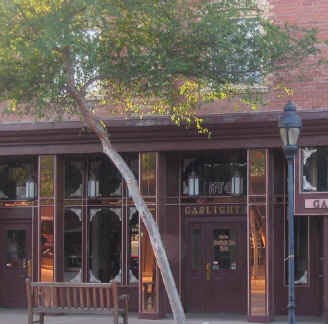
Located on the Western edge of Phoenix, Glendale is a convenient 20 minutes from Phoenix Sky Harbor International Airport.
As Arizona's fourth-largest city and home to the 2008 Super Bowl, Glendale offers travelers a wide variety of amenities including the famous Historic Downtown shopping district, legendary special events and festivals, museums and cultural attractions, and a growing number of professional sports facilities.
Glendale is a well-planned blend of Old West and New Economy. It's one of the fast-growing Arizona cities, yet remains most famous for its well-preserved charm. We welcome you to discover Glendale.
In 1880, the land that is now Glendale was nothing more than empty desert. But in 1882, William J. Murphy joined three Arizona builders, M.W. Kales, William A. Hancock and Clark Churchill, to lead the Arizona Canal Co. project, which would bring water to the desert land. With the help of 225 mules and whatever machinery was available, Murphy and his team completed the canal in May 1885. By the late 1880s, several homesteaders began to settle around the new canal. One early settler, William H. Bartlett, homesteaded lands in what is now central Glendale. He started a 640-acre fruit farm in 1886, complete with a main house and 13 other buildings. It became known as the Sahuaro Ranch.
In 1888, Murphy, with the help of others, constructed the diagonal Grand Avenue. And on February 27, 1892, (which Glendale celebrates as its birthday) the first residential area of the city began to take shape. The Glendale town site began to take shape soon after, and the first school, the Glendale Grammar School, was build in 1895. Its opening drew people from all over the Valley. In the mid 1890s, Glendale became the pathway for a line of the Santa Fe Railroad, linking the Valley to Prescott and northern Arizona. The railroad allowed Glendale settlers to transport goods to the north and easily receive building materials.
Victor E. Messinger, one of the first graduates of Stanford University, came to Glendale in 1895 and helped found the town’s first library with 400 books from his own collection. The first library was soon built on what is now Murphy Park.
Glendale in the Early 1900s
More and more families began to settle in Glendale after the turn of the century. The Glendale State Bank was opened in 1909. The city’s water system was sold from the Sine family to the town government in 1915. By the early 1900s, the large ranch home on 51st and Northern avenues was bought by Louis M. Sands, a wealthy lumberman and rancher. He named the surrounding land and Victorian home Manistee Ranch after his hometown in Michigan. It remained one of the last working cattle ranches in the Valley. The house has been preserved for future generations to see.
Over the years, Glendale grew to become one of the most culturally diverse cities in the Valley. The city owes much of its heritage to early Hispanic settlers as well as Japanese and Russians who moved to Glendale from California.
Glendale’s Beet Sugar Factory, whose structure still stands today just southeast of Glendale’s downtown, was instrumental in the city’s early economic success. Farms and orchards continued to take off through the early 1900s. Other early businesses included the Glendale Ice Co., the Pacific Creamery Co., the Southwest Flour and Feed Co. and the Glendale Milling Co.
World War I brought a new surge of energy into Glendale, with cotton prices reaching $2 a pound and a high demand for food, which kept farmers busy. There was soon a need for more housing, and today’s Catlin Court was born from 1915 to about 1930. Most of these homes are still standing and are on the National Register of Historic Places.
The first Glendale News was published in 1912, the day after Arizona became a state. A second newspaper was opened in 1926, The Glendale Herald. It published until 1963.
Glendale’s school system also experienced growth. Glendale High School was built in 1912 at a cost of $20,000. The Glendale Grammar School, now known as Landmark Elementary, blossomed into several buildings.
Though the early parts of the 1900s brought about economic success and street paving, Glendale also was affected by the Depression. Federal Housing Administration money helped build additional homes in Catlin Court from about 1935 to 1942, and the city’s population grew from about 3,500 to more than 4,800 by 1940.
The Road to Modern Glendale
World War II brought the birth of Thunderbird Field to train civilian pilots for the Army. The field was designed by artist Millar Sheets and resembled the mythic Thunderbird. While this field was being built in 1941, the Army was busy working on a larger base 10 miles west of Glendale. Built for $4.5 million, Luke Field (now Luke Air Force Base) was named for the first pilot to receive a Medal of Honor, Lt. Frank Luke Jr. Thunderbird Field would later become the Thunderbird American Graduate School for International Management.
The military and college presence sparked a need for utilities, parks, schools and streets. Northwest Hospital was built in 1960 at 61st and Northern avenues and city officials in the 1960s began to play catch up with the population, and over the next 40 years, the city added an operations center, landfill, water treatment plant, sewage plants, libraries, parks, public safety facilities an airport, a city hall and a civic center.
By the end of the century, Glendale’s school systems had grown from a handful of schools to multiple districts, including the Glendale Elementary, Peoria Unified, Deer Valley Unified and Glendale Union High School districts.
The 1990s saw infill projects such as Marshall Ranch and Marbrisa Ranch as well as the changing of Valley West Mall to Manistee Towne Center. The shopping area at 59th and Northern avenues is now Northern Crossing, a successfully redeveloped power center complete with a super Wal-Mart and Lowes home improvement store.
Arrowhead Towne Center opened in 1993, and the surrounding neighborhood, Arrowhead Ranch, continues to be one of the most sought after communities in the Valley. Arizona State University’s west campus grew into a major educational institution in recent years, and Glendale also became home to Midwestern University. The completion of Loop 101 throughout Glendale opened the city to the rest of the Valley.
Glendale today is poised to become the sports destination for all of Arizona, as the Glendale Arena and NHL Coyotes continue to attract fans to new growth in the far western areas of the city. The state-of-the-art Cardinals Stadium is almost complete, and Glendale recently hosted the 2015 Super Bowl. It should be exciting to see what the future holds.
Learn more about Glendale history at the Glendale Historica Society office, located in the historic Saguaro Ranch Park, 9802 N. 59th Ave., Glendale.
Goodyear History
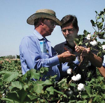
The Goodyear of today exists because of the cotton of yesteryear. It was part of the 16,000 acres purchased in 1917 for the Goodyear Tire and Rubber Company by junior executive Paul Litchfield. Cotton used to make rubber tires for airplanes in World War I was in short supply because foreign sources were in war torn countries or disease ridden.
When Goodyear found that Arizona’s climate and soil was similar to foreign sources, the company sent Litchfield to purchase land. The small community that formed as a result of the Goodyear Farms cotton industry first became known as “Egypt” for the Egyptian cotton grown there and then, finally, was called “Goodyear.”
The community thrived as long as the cotton industry was strong. But after the war, cotton prices plummeted and Goodyear’s economy suffered. However, World War II brought a recovery in the early 1940’s when the Litchfield Naval Air Facility and the Goodyear Aircraft Corporation located here, employing as many as 7,500 people at one time. Dirigibles or “blimps” were built at the Goodyear Aircraft Corporation.
After the war, the Naval Air Facility served as a storage base for thousands of World War II aircraft that were moth balled and salvaged. Then, in 1968, the Navy sold the airfield to the City of Phoenix which named it the Phoenix-Litchfield Airport. In 1986, it was renamed the Phoenix-Goodyear Airport.
The town of Goodyear was incorporated in November 1946. At that time, the town had 151 homes, 250 apartments, a grocery store, drug store, barber shop, beauty shop and service station. Then, in 1949, a long history of aerospace and defense programs began in Goodyear when the Goodyear Aerospace Corporation replaced the Goodyear Aircraft facility. That plant was later sold to Loral Defense Systems and eventually evolved by merger and acquisition into the current Lockheed Martin Corp.
In the 1980s, the 10,000 acres that remained of the original Goodyear Farms was sold to SunCor which eveloped much of the land into the Palm Valley master-planned, mixed-use community located north of I-10 in Goodyear. The town became a city in 1985.
For more information about Goodyear history, visit the Three Rivers Historical Society, or call 623-386-1397.
Litchfield Park History

The planting of Egyptian cotton in the Litchfield Park area by the Goodyear Tire and Rubber Company began in 1916. Two tracts of land were purchased by the company. One became the city of Goodyear and the other became Litchfield Park. Egyptian cotton was the key component in creating tire cords for the company. As a matter of fact, Paul Litchfield was a Goodyear vice-president for which the city was named. Litchfield was credited with coming up with the ideal location for growing the cotton needed for manufacturing.
Then in the 1960’s, the area was developed into a master planned community. The city was designed around the concept of creating several self-sufficient villages. This concept can still be seen today. Litchfield Park is a city with beautiful surroundings.
To learn more about Litchfield Park history, visit the Litchfield Park Historical Society at 13912 W. Camelback Rd., Litchfield Park.
Peoria History

The City of Peoria was established in the 1880’s when William J. Murphy’s vision of fertile farm lands fed by water from the Salt River became reality with the completion of the Arizona Canal in 1885. Once this canal was completed, Murphy went East to interest people in settling in this new community. Mr. Murphy was successful in catching people’s attention – over 5,000 acres of land in the new district was purchased by citizens from Peoria, Illinois. Four families from Peoria, Illinois were among the first to move to Arizona to occupy and work their land.
Residences in the new community sprang up, and a school and Post Office were established by 1889. More people followed the original families and Peoria continued to grow as a farming community. The farmlands were fertile and the people made a good living, despite having to battle swarms of red ants and the occasional rattlesnake in the kitchen.
Peoria was incorporated in 1954, with boundaries covering one square mile of land. The warm climate and small-town atmosphere of Peoria continued to attract people, and still do today. Currently, Peoria covers 162 square miles, and is home to over 120,000 residents. Peoria is Arizona's 4th largest city in terms of incorporated area, and 9th largest city in terms of population.
From a simple visionary farming community, Peoria, Arizona - a dynamic desert city, has grown.
Phoenix History
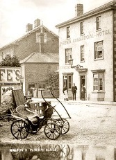
Phoenix was incorporated in 1881, the charter of that year being revised in 1893.
The earliest settlers in the Valley of the Sun were the Hohokam people, who lived there as early as 300 BC. They were the first to farm there, building an elaborate canal system that brought water from the Salt River. Their name is derived from their O'odham name, Huhu:gam. They also lived in the Pueblo Grande ruins between 700 and 1400 A.D. Their irrigation system comprised some 135 miles (217 km) of canals. Their disappearance ca. 1450 A.D. remains a mystery. Prolonged drought may have destroyed or displaced them; or, they may be the ancestors of the modern Pima who now live on the Salt River and Gila River reservations and the Tohono O'odham who live in southern Arizona.
Early Phoenix
In 1867, Jack Swilling of Wickenburg stopped to rest his horse at the foot of the north slopes of the White Tank Mountains. He looked down across the expansive Salt River Valley and his eyes caught the rich gleam of the brown, dry soil turned up by the horse's hooves. He saw farmland, predominantly free of rocks, and beyond the reach of heavy frost or snow. All it needed was water. By 1868, he and others from Wickenburg had dug a short canal from the Salt River and founded a small farming colony approximately four miles (6 km) east of the present city (about 22 miles west of Mesa, which was already a city of 1,000 people; and a few miles northwest of a similar farming community at Hayden's Ferry, which would become Tempe).
The area was named Swilling's Mill in his honor. It would later become Hellinwg Mill, Mill City, then East Phoenix. As for the town that was to be built, Swilling, a former Confederate soldier, wanted to name it Stonewall, after Stonewall Jackson; others suggested Salina.
Darrell Duppa recommended the name Phoenix, memorializing the birth of a new civilization from the ruins left by the Hohokam.
The town of Phoenix was officially recognized on May 4, 1868, when the Board of Supervisors of Yavapai County (which at the time encompassed Phoenix), formed an election precinct there. The Phoenix post office was established June 15, 1868, with Jack Swilling as postmaster.
The area was surveyed in 1870 and mass meeting of the citizens of Salt River Valley was held on October 20, 1870, to select a suitable piece of unimproved public land for a town site. They recommended the North 1/2 of section 8 Township 1 N., Range 3 E. and that the town be called Phoenix.
On February 12, 1871, the territorial legislature created Maricopa County, the sixth in the state, by dividing Yavapai County. Maricopa county gave up portions in 1875 and 1881 to help form Pinal and Gila counties, respectively. The first county election in Maricopa County was held in 1871, when Tom Barnum was elected the first sheriff of Maricopa County.
The first public school in Phoenix opened on September 5, 1872, in the courtroom of the county building. By October 1873, a small adobe school building was completed on Center Street (now Central Avenue), a short distance north of where the San Carlos Hotel now stands. Miss Nellie Shaver, a newcomer from Wisconsin, was appointed as the first female schoolteacher in Phoenix.
On April 10, 1874, President Grant issued a land patent for the present site of Phoenix. The total cost of the Phoenix Townsite of 320 acres (1.3 km2) was $550, including all expenses for services.
By 1881, Phoenix had outgrown its original townsite-commissioner form of government. The 11th Territorial Legislature passed the Phoenix Charter Bill, incorporating Phoenix and providing for a mayor-council government. The bill was signed by Governor John C. Fremont on February 25, 1881. Phoenix was incorporated with a population of approximately 2,500, and on May 3, 1881, Phoenix held its first city election, in which Judge John T. Alsap defeated James D. Monihon, 127 to 107, to become the city's first Mayor.
Growth of Phoenix
The coming of the railroad in the 1880s was the first of several important events that revolutionized the economy of Phoenix. Merchandise now flowed into the city by rail instead of wagon. Phoenix became a trade center with its products reaching eastern and western markets. In recognition of the increased tempo of economic life, the Phoenix Chamber of Commerce was organized on November 4, 1888.In early 1888, the city offices were moved into the new City Hall, built where the downtown bus terminal now stands. This building also provided temporary offices for the territorial government when it moved to Phoenix from Prescott in 1889.
In 1902, President Theodore Roosevelt signed the National Reclamation Act making it possible to build dams on western streams for reclamation purposes. Valley of the Sun residents were quick to supplement this federal action by organizing the Salt River Valley Waters Users' Association on February 4, 1903, to assure proper management of the precious water supply. It functions to this day as the major agency for controlled use of irrigation water in the Valley.
On May 18, 1911, the Theodore Roosevelt Dam, then the largest masonry dam in the world, began operation. It created Roosevelt Lake, expanded irrigation of land in the Valley for farming, and increased the water supply for the growing population.
On February 14, 1912, President William Howard Taft approved Arizona's statehood, making Phoenix the state capital.
In 1913, Phoenix changed its form of government from mayor-council to council-manager. Phoenix was one of the first cities in the United States to have this form of city government.
In 1924, President Calvin Coolidge sold 13,000 acres (53 km²) of South Mountain to the city of Phoenix for $17,000. At its present size of 16,500 acres (67 km2), South Mountain Park is the largest metropolitan park in the world, and it entertains 3 million visitors each year.
Phoenix began to grow into a young metropolis. By 1920, Phoenix had a population of 29,053 inhabitants, which by 1930 had grown by 60%, to 48,118.
1940 marked another turning point, as the war changed Phoenix from a farming center to a distribution center. Phoenix rapidly turned into an embryonic industrial city with mass production of military supplies. Luke Field, Williams Field and Falcon Field, coupled with the giant ground-training center at Hyder, west of Phoenix, brought thousands of men into Phoenix.
In 1950, 105,000 people lived within the city limits and thousands more lived in adjacent communities and depended upon Phoenix for their livelihoods. The city had 148 miles (238 km) of paved streets and 163 miles (262 km) of unpaved streets, a total of 311 miles (501 km) of streets within the city limits.
Phoenix has been selected four times since 1950 as an All-America City, rare among larger cities. The hallmark of an All-America City is the extent to which its private citizens get involved in the workings of their government. Thousands of citizens have served on various city committees, boards and commissions to assure that major decisions are in the best interest of the people.
In 1993, Phoenix was selected as the "Best Run City in the World", also known as the Carl Bertelsmann Prize, by the Bertelsmann Foundation of Germany, a branch of Bertelsmann media company. It shared the honor with Christchurch, New Zealand.
Surprise History
 Surprise was little more than a gas station and few small houses in 1938 when founder, Homer Charles Ludden, a
Glendale real estate developer and state legislator, subdivided the rural square mile parcel into low-cost home
sites for the area’s agricultural workers, naming it after his southeast Nebraska hometown.
It was originally El Mirage 2, where those who “made good” could move up to a nicer neighborhood, according to his daughter, Katherine Lieber, and stepdaughter, Virginia Fetterer. El Mirage - where a park is named after him - was established first as a haven for the poor. “He believed everyone should have the opportunity to own a piece of land,” Fetterer said.
Ludden, born Nov. 27, 1880 to Charles W. and Emma Jane Clark, moved to Glendale in 1905 and went to work as a milkman. He started dating fellow Nebraskan Edna Robinson, the daughter of a customer on his Glendale route and they had “an understanding” until a lover’s quarrel broke them up, according to later newspaper accounts. Robinson married John Prichett and had a child, Virginia.
Ludden remained a bachelor and from 1912 to about 1916 worked as a mail carrier on Glendale’s first rural route. He opened a small real estate office on the northwest corner of Glendale and 59th avenues, adjoining the Ludden/Gillett service station. His partner was Glendale founder and brethren minister Charles Gillett.
After Robinson was widowed, the pair resumed their relationship and by the time they married on Sept. 27, 1922, Ludden was “prominent rancher and business man,” a member of the Glendale Town Council, a charter member of the Glendale Masonic Lodge and a large property owner in Glendale, according to the newspaper announcement of their marriage. That same year, the Democrat was elected as a representative to the sixth State Legislature. He served three terms – eight years in all - including some special sessions in 1928 under Gov. George W.P. Hunt.
Robinson divorced Ludden in 1948, and much to the surprise of friends and family, Ludden married Flora Mae Statler - daughter of his former partner, Gillett - in about 1950.
Statler started working for Ludden in the early 1920s pumping gas, but gradually became more involved with the real estate office. It’s Statler’s name that appears on Surprise’s first subdivision plat dated April 15, 1938, and until Ludden’s family stepped forward with documentation a couple of years ago, she was credited with the founding and naming of Surprise.
The story was that Statler, upon subdividing a piece of land, remarked that it ever became a town it would be a surprise.
No surprises when the City incorporated in 1960 with a population of about 1,000, and even when Del Webb’s highly successful Sun City swelled westward, Surprise stayed a sleepy square-mile stop on Grand Avenue. The boundaries stretched a little when Happy Trails and Sun Village opened in the early 1980s and Bell Road was widened to make way for development, but it was the slingshot growth of the 1990s that brought Surprise to 72-square-miles.
Between 1995 to today, the population has multiplied exponentially - from 10,187 to an estimated 96,000 by the end of 2005. There were more than 7,000 new home starts in 2004. That translates to a new home completed almost every hour, on average, and 50 new residents a day.
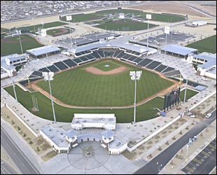
Even the Kansas City Royals and Texas Rangers decided to take up residence here. The once-sleepy square mile farming community surprised just about everyone last fall when it successfully courted the two teams away from their Florida training homes, and snagged $32 million in funding from the Maricopa County Tourism and Sports Authority.
The $48.2 million Cactus League Spring Training facility and stadium was completed in 2002, along with a regional library, aquatic center, recreation center, and passive park – the first installments on a square-mile-plus downtown development dubbed Surprise Center. A joint venture with Carefree Partners (a division of Valley shopping center developer Westcor) it will feature government offices, shops, upscale restaurants and entertainment venues.
In fact, about 75 percent of expenditures in Surprise’s $336 million 2005-06 budget are for capital projects. The budget includes a Public Safety Building, two fire stations, a 25-court tennis center, three water reclamation facilities, design of a new city hall and nearly $18 million in roadway improvements. Yet, Surprise property tax rate ranks among the lowest in the state at .9101 per $100 of assessed valuation.
Commercial development is booming, as well. The state’s largest Wal-Mart Supercenter and a sizeable Home Depot opened in 2000 as anchor tenants of Surprise Towne Center, a power retail development. Situated on the northwest corner of major thoroughfares, Grand Avenue and Bell Road, it features more than 40 locally and nationally known stores including PetsMart, Office Max, Famous Footwear, banks, restaurants. Just across the road, Target and Lowe’s Home Improvement Center anchor a sprawling commercial center, Surprise Marketplace, and throughout the 76-square-mile city, churches, gas stations, grocery and drug stores, are cropping up.
The Dysart Unified School District has opened a two kindergarten through eighth grade elementary schools a year for the past three years. A new high school opened in 2003 and another one is expected to open in August of 2006.
Opened in 1996 in Surprise, Rio Salado Community College’s Lifelong Learning Center services about 5,000 students a year with a wide variety of courses including GED preparation, basic to advanced computer programming, special interest, and associate degree programs. Estrella Mountain Community College is now offering courses on the campus of Willow Canyon High School and nearby Del E. Webb Memorial Hospital expanded to include women’s services, labor and delivery, and pediatric neonatal wing.
More growth is on the horizon.
With projections that Surprise’s population could hit 364,000 by 2020, city leaders are taking a proactive approach to planning. Approved by voters in 2001, the city’s updated general plan encompasses a 310 square-mile planning area and serves as a road map to the future.
It addresses such critical issues such as open space, economic development, revitalization of the Original Townsite, and mass transit needs. Leaving nothing to chance, city leaders are soliciting citizen input, coordinating with other cities, then establishing short, medium and long-term goals to bring the future of Surprise into focus: a well-rounded community beyond expectations where residents love to live, work and play.
To learn more about Surprise history, visit the Surprise Regional Chamber of Commerce at 16126 N. Civic Center Dr., Surprise.
